
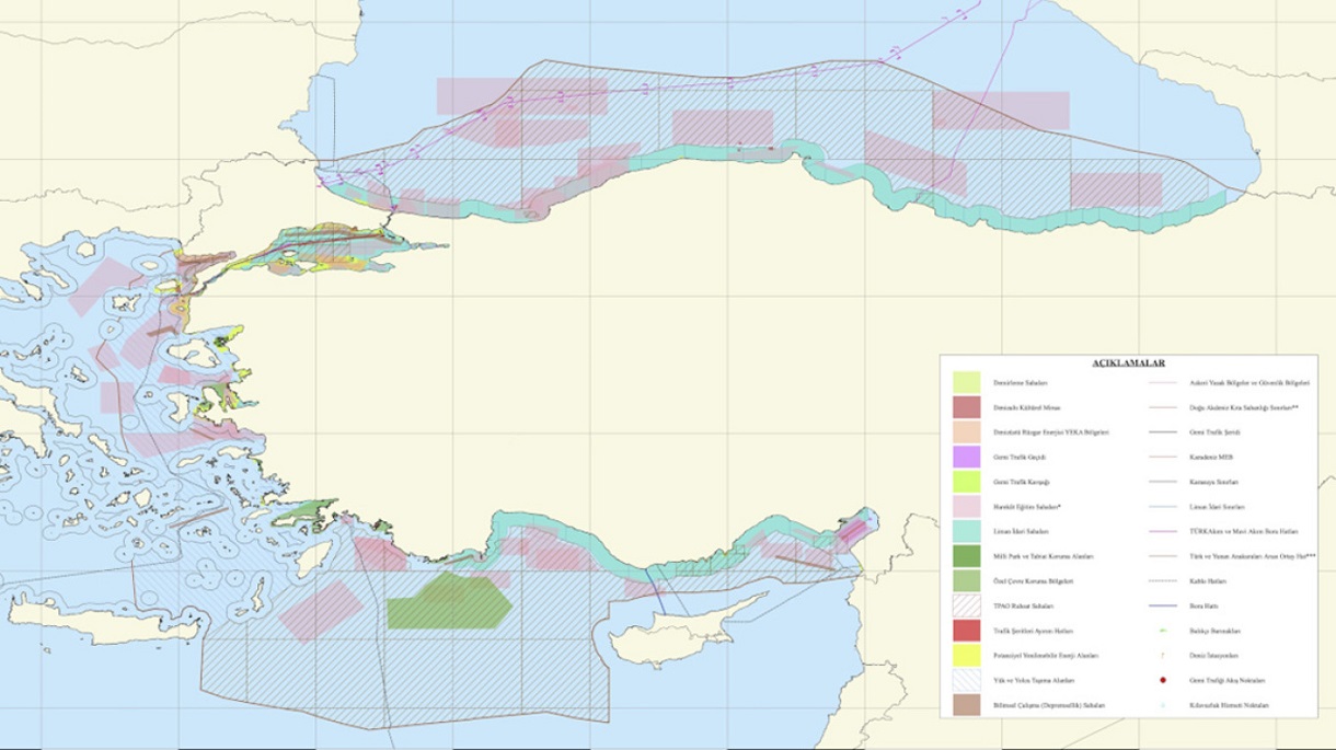
Turkey has publicized maritime spatial planning by sending the map to the UNESCO competent service and including areas in the Aegean.
By sending its own maps to the UNESCO competent department, Turkey is trying to respond to Greece and the completion of the first stage of the Athens Planning Planning from Athens.
This is the first step in defining anthropogenic activity in the marine environment, a plan that, as Athens has announced, will soon be communicated to the UN.
“The maritime spatial planning of the Republic of Turkey, prepared under the coordination of Dehukam with the contributions of all relevant institutions and interested parties, was notified to the public on April 16, 2025, after submitting it to the ILO-ISCO for an official registration, refers to the relevant announcement.
The maps presented by Turkey once again highlight Ankara’s revisionist policy, which reinstates the “midline” theory between Turkey and mainland Greece.
As shown in the red line, which starts from the estuary of Evros, it passes north and south of the Dodecanese, excluding the islands’ continental shelf and recognizing only the seaside zone of 6 nautical miles.
The map of Greece
Blue in the west of mainland Greece is the Ionian region that is bounded by the Adriatic from the agreed boundaries of the exclusive Economic Zone of Greece – Italy. The line -up section in the blue context appears to be the demarcated EEZ of Greece – Italy. In the yellow color of the map the Greek continental shelf appears in the North Aegean.
Includes Lemnos, Samothraki, Mytilene and Chios and for the boundaries of the Greek continental shelf to the east, the midline rule has been used.
The Greek continental shelf is reflected in the central, southern and eastern Aegean. For the influence of the Greek marine zones east of the Dodecanese complex, the midline rule has again been used.
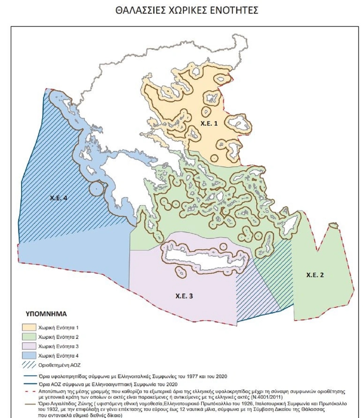
The marked section in the section that is mapped in green has the boundaries of the Hellenic Egyptian EEZ. The section east of Kastellorizo appears to end east of the line -up part of the Greek Egyptian EEZ because the map includes the ultimate potential limits of the Greek continental shelf.
The colored purple part of the map includes the Greek continental shelf in Crete. The Marked Department includes the boundaries of the Greek continental shelf as formalized by the Hellenic Egyptian Party of the partial demarcation of an exclusive economic zone between Athens and Cairo. Here, west of the demarcated EEZ, the boundaries of the Greek continental shelf are greater because the maritime border with Libya records the maximum of Greek requirements for the demarcation of the Greek continental shelf.