
Smoke from fires erupted in the country’s forests on Wednesday (02.07.2025) are recorded by a satellite image, with references to damaged areas.
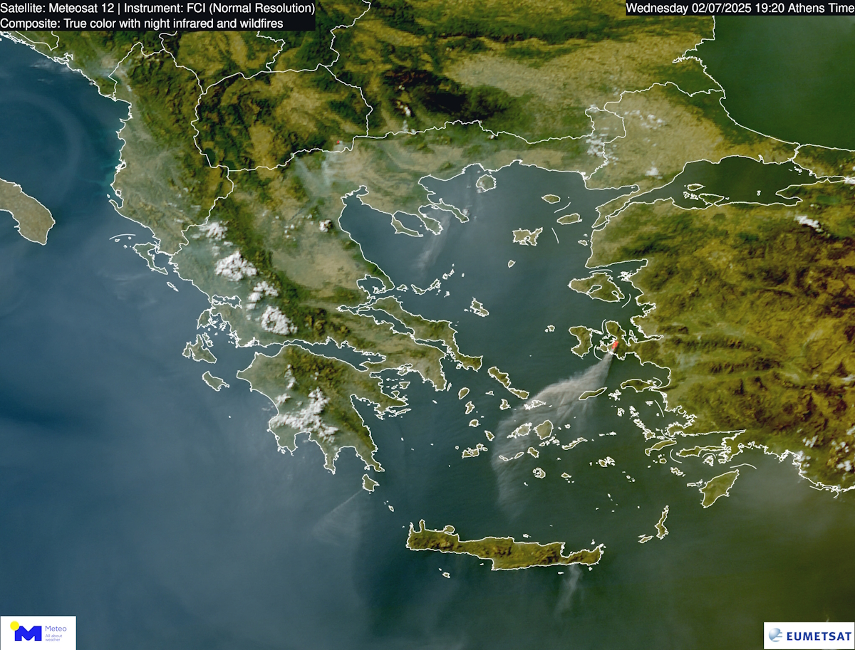
The director of the Meteo Meteorological Service of the National Observatory of Athens, Costas Lagouvardos has published a satellite image that captures the tobacco from the fires affecting Greece, as well as the flames that burned Smyrna for days.
Mr. Lagouvardos stresses that these tobacco come from the forest fires raging in Vourbourouto Ierapetra and in Kytheraas well as from the area of Smyrna on the Asia Minor coast of Turkey.
Specifically, this image, taken by the European meteorological satellite Meteosat-12, clearly shows extensive tobacco to cover areas of the sky above the country and the eastern Aegean.
In Sithonia, Halkidiki, the fire broke out in Mandinia at noon on Wednesday and burned pine forest, while in Lasithi the fire extends to a farm area.
In the “pseudo -colored” satellite image from 7:20 pm (Greek time), extensively tobacco are clearly covering parts of the celestial dome above the country and the eastern Aegean.
These fires confirm the seriousness of the situation and the constant challenges facing the region.