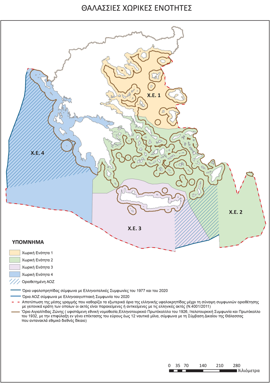
Significant first step towards the registration of sovereign rights of the countryarising from the Sea lawis the approval of Marine spatial planning and his expected deposit in Commission, As it captures existing and potential Country’s marine zoneswith the map now acquiring European status.
The Map of the HCS captures the defined EEZ with the two agreements with the Italy and with the partial delimitation agreement with the Egypt, While in all other areas there is a potential EEZ, as defined under Law 4001/2011, which sets out the external limit of the EEZ in the midline with countries with which there has been no demarcation agreement.
See the map

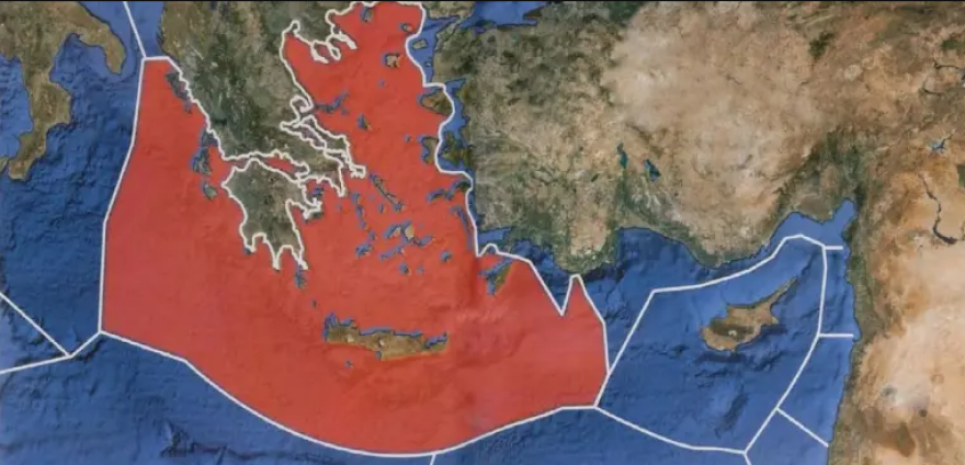
With the map approved and released, essentially for the first time Greece captures its claims on the continental shelf/EEZs under sea law. This is also the most valid response to Turkey’s unilateral attempt to impose its “external boundaries” of its EEZ, which it calculated on the basis of it on the basis of its “external boundaries”. Turquoisealso questioning Greece’s demarcation agreement with Egypt.
Turkey’s “Nightmare”, also known as “Seville map“, Is now reflected in an official Greek document, which is published in Government newspaper and deposited in the EU. It is also attributed by Greece full influence on the continental coasts, all islands and islands and in the Castellorizo, thus bringing the potential Greek EEZ to the western boundaries of Cypriot EEZ.
The so -called Seville Map:

On the map they are imprinted and the country’s existing territorial watersat 12 nm In the Ionian Sea and at 6 nm In the rest of the areas, with the special labeling for “reserving the exercise of the right to expand up to 12 nm”, under the law of the sea, which – as noted – is customary international law. This underlined the compulsory nature of sea law, even for countries such as Turkey, which is not a Contracting Party in the Convention.
The approval of the ICS does not constitute an act of proclamation or demarcation of the EEZ, However, by imprinting the existing boundaries and potential boundaries under sea law in the rest of the regions, Greek positions are now recorded in European text and form the basis for any discussion with Turkey and Libya on the demarcation of the maritime zones.
OR Turkey, Autumn, when it was first published by the Commission A technical map for the Greek MScs had reacted strongly, stating that the map was “unacceptable”, warning that it would not accept adequately, while restoring the theory of “gray zones”, arguing that they were recorded on the map and island formations.
In a particularly thin phase for the Greek -Turkish, Turkey’s reaction to the approval of the MSS is of particular interest, as – among other things – its determination is also mediated. Kyriakos Mitsotakis’ visit in Ankara and the meeting of the Supreme Cooperation Council.
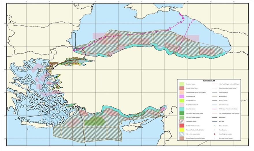
It is no coincidence that, In her post, the Nationality Today she spoke about the final actions for Turkey to publish its own maritime spatial planning, which, according to newspaper information, will take into account the “midline” between the two continental coasts, thus completely depriving the islands and islands from sea zones. And, of course, in the Turkish design will capture all the claim of the “blue homeland”, the Turkolibyy Memorandum and the unilateral and arbitrary definition of supposedly external boundaries of the Turkish EEZ, which overlaps much of the Greek and Cypriot.

The approval of the MSS It is not directly related to the case of research on the cable of the Cyprus -Crete electric interconnection cable, which have been postponed by Turkey’s threats. However, it is a move that, in addition to solving a serious pending country against the EU, sends the message that there is no withdrawal from the sovereign rights that Greece offers to Greece.
The approval of the MSS does not create an immediate obligation to practice activities In imprinted areas and at least theoretically, it removes a Turkish reaction to the field. However, it cannot be predicted how Turkey will choose to send its own “messages”.
Marine Spatial Planning (HSS) captures human activities in all marine zones of our country, with the aim of protecting the environment and sustainable development of marine areas and utilizing marine resources.
This procedure is provided for in Directive 2014/89/EU and in this way the European obligation of our country is fulfilled.
The HSS defines all in activities such as protecting the marine environment from the effects of climate change -among other things – By definition of marine parksthe preservation of our cultural heritage and in particular of the Nine Antiquities, the improvement and protection of marine transport, the sustainable tourism development, the exploitation of the country’s energy resources and in particular the potential natural gas deposits, and our offshore winds,
Greece is ultimately to its obligation to the EU, as the deadline for the submission of the MSS has expired in 2021 and has been a conviction of the European Court of Justice, which had set April 27 as a deadline for a deadline. for the approval and submission of marine spatial planning. This plan was completed by the relevant departments of the Ministry of Environment and Energy, but the final political approval was pending by the Ministry of Foreign Affairs.
