Answer In the challenge of Ankara Athens is published by its own maritime spatial planning, through an official announcement by the Ministry of Foreign Affairs, which emphasizes that the Turkish map has no legal basis and does not produce legal results.
As the Foreign Ministry notes Turkey He is trying to respond to the Greek design, which has already joined the European acquis, promoting a map that “has no basis in international law” and “attempts to usurpate areas of Greek jurisdiction”. At the same time, it is noted that Ankara does not address this map to an international organization with the responsibility of suspension of such documents, which makes the Turkish movement legally non -existent.
The Ministry of Foreign Affairs describes Turkish planning a “reflective reaction of empty content” and emphasizes that Greece will continue to implement a steadily policy of authorities. It calls on Turkey to abandon the “maximalist positions” which, as it is mentioned, “is for internal consumption alone”.
The Greek side is also determined to take “proper actions in all international forums”, escalating its diplomatic initiatives in response to the Turkish challenge.
The entire announcement of the Ministry of Foreign Affairs:
“Turkey has today released maritime spatial planning in response to Greek design, which is already part of the European acquis.
The difference is that the Turkish Charter has no basis in international law, as it attempts to usurpate Greek jurisdiction, and is not aimed at an international organization that imposes an obligation to suspend maps.
Therefore, it does not produce any legal effect and is simply a reflective reaction of empty content.
Greece will insist on the policy of authorities it implements and calls on Turkey not to put forward maximalist claims that everyone understands that it is for internal use alone.
Greece will take appropriate action in all international forums. “
The time
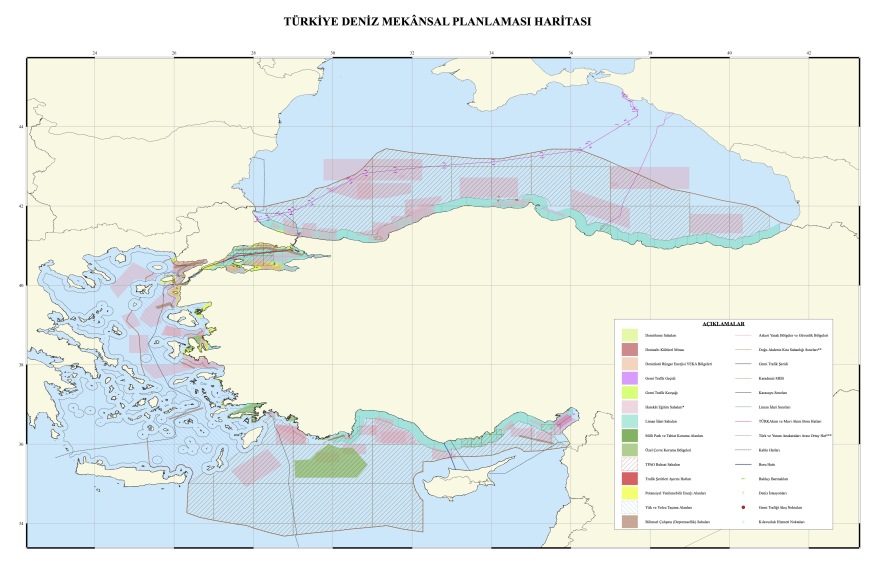
The announcement follows the mission, on the part of Ankara, its own maps to the UNESCO competent department, where the influence of the Greek islands is challenged and restores the theory of a “midline” between Turkey and mainland Greece. Characteristic is the red line that starts from the estuary of Evros and runs north and south of the Dodecanese, excluding the islands’ continental shelf and recognizing only the coastal zone of 6 nautical miles.
The map was designed by the University of Ankara and was officially submitted to UNESCO as a “scientific” presumption. In its southeastern part, in the eastern Mediterranean, the plots given to the Turkish state -owned oil company (TPAO) for research – areas that overlap Greek claims and are directly related to the so -called “blue homeland” are depicted with diagonal lines.
In addition, pink marks are the permanent firing fields, that is, the areas of exercise unilaterally defined by Ankara.
Special reference is needed by the black line that runs through international waters north of Crete and reaches the Dardanelles, which Turkish maps characterize a “cable”, without providing further explanations for the purpose or nature of this infrastructure.
See the map:

Reaction to Greek initiative
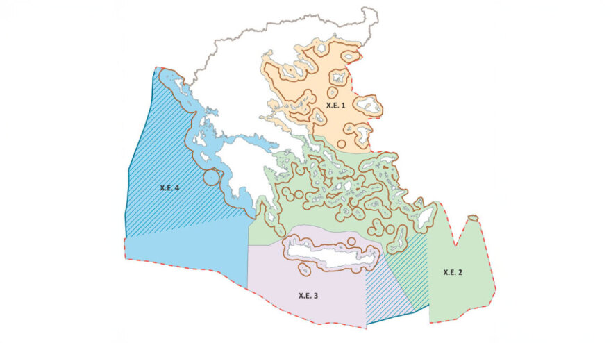
Greece had caused the intense Turkish reaction announcing the start and gradual completion of the marine spatial planning. For the first time, the country defined the geographical framework of its activities in the marine environment – energy based on European and international law and constitutes a substantial step of national sovereignty.
See the Greek map:

