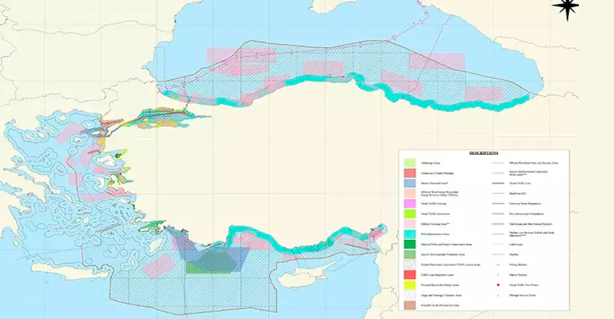
The Turkish map for the sea parks In the Aegean and Eastern Mediterranean announced by Turkeya few days after the corresponding announcements of the Greek side, for maritime parks in the Aegean and Ionian Sea, with the aim of protecting marine biodiversity.
The map shows that the maritime park announced by Turkey to Aegean extends out of territorial waters west of Imbros and Tenedou, between Samothrace and Lemnos.
To Eastern Mediterranean, The marine park excludes, in the consistent Turkish position, the Castellorizel After starting northeast of Rhodes and reaches up to its open Gulf of Antalya.

Turkish media reports that new maritime parks were registered on the map submitted to intergovernmental Oceanographic committee her UNESCO. The update, sources at the Turkish Foreign Ministry report was incorporated into the map that had prepared the National Legal Law Research Center of the Dehukam University, with the contribution of competent bodies and was registered last month to the UNESCO committee.
Ankara’s goal is to announce other maritime zones in Turkish coastal waters.


Turkey had announced the announcement
Ankara’s announcement was expected and had been announced, following the irritation caused by the Greek initiative to institutionalize two National marine parks in Ionian and Southern Aegean (Southern Cyclades) totaling 27,500 km2.
The prime minister Kyriakos Mitsotakis He had pointed out, in the announcement, that “with both parks Greece acquired from the largest marine protected areas throughout the Mediterranean”.
