
Shock causes its satellite map NASA for them fires as the Mediterranean appears to be burning from end to edge.
As shown and In the relevant NASA link The fires are burning throughout the Mediterranean with Greece and Italy recording most red dots.
Each red dot in satellite photos corresponds to a small or large forehead that is ongoing.
The images correspond to the ongoing fiery fronts in the last 24 hours and the last week.
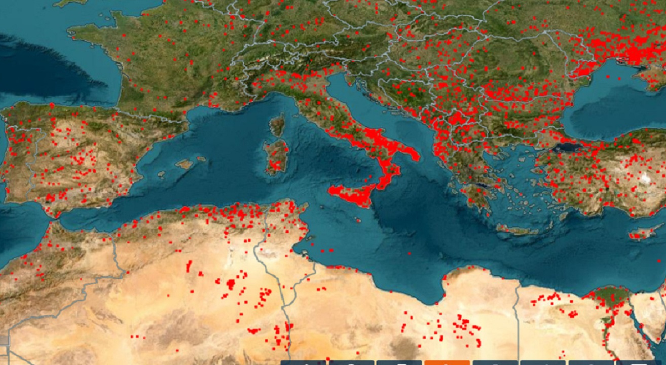
It should be noted that red dots show primarily fires in forests and in agricultural land.
Many dots show human activities such as factories, fires that the farmers light up in their fields and refineries.